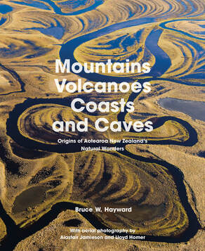
Mountains, Volcanoes, Coasts and Caves: Origins of Aotearoa New Zealand’s Natural Wonders
by Bruce W. Hayward
With aerial photography by Alastair Jamieson and Lloyd Homer
This is a truly wonderful book. A comprehensive journey though Aotearoa New Zealand and the many and varied geological points of interest.
Covering the country from Northland to the Bluff including Stewart and Chatham Islands, the construct is not unlike that of the many illustrated ‘places to vist’ volumes we see. In this one, though, instead of merely showing the beautiful scenery, the author looks underneath to divulge how it has been created. Despite having not had the opportunity to experience previous publications by Bruce Hayward, it is obvious to me from the outset that he possesses a vast scope of expertise in this area.
This approach is assisted ably by the beautiful photography and clear illustrations that accompany each short chapter. The photography, as mentioned in the introductory page, is astounding and it comes as no surprise that both contributors, Alastair Jamieson and Lloyd Homer, are highly respected in their own right.
In addition to being a thoroughly enjoyable read, this book is extremely educational and would be valuable required reading for anyone studying the geology of our unique country. There is also a full glossary of the more scientific language to help the reader gain a full understanding even if fresh to the subject.
From cooled lava flows to glacial moraine, wind and water erosion to plate movement and earthquakes, this volume has it all and my initial response was that a light had been shined on some very familiar sights, completely altering my appreciation of them. It mattered not that I had little or no previous knowledge or interest in any of the above, I found myself engrossed within a few pages.
I would recommend this book to anyone and most especially to anyone who would like to learn more about what has gone and is going on under our feet.
Review by George Hollinsworth
Title: Mountains, Volcanoes, Coasts and Caves: Origins of Aotearoa New Zealand’s Natural Wonders
Author: Bruce W. Hayward
Publisher: Auckland University Press
ISBN: 9781869409678,
RRP: $69.99
Available: bookshops
Author: Bruce W. Hayward
Publisher: Auckland University Press
ISBN: 9781869409678,
RRP: $69.99
Available: bookshops
 RSS Feed
